
The Joint Rivers Commission of Bangladesh and India has identified ten rivers shared by the two countries that they wish to manage together. These are the Moharoshi, Uddakhali, Sonkosh, Mohadeo, Harivanga, Chela, Luva, Loha, Kamjhora and Khasimara, located in northern Bangladesh, with the Indian states of Meghalaya and Assam across the border.
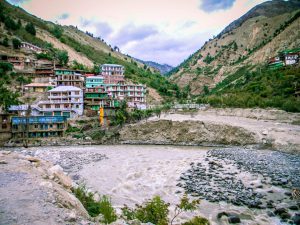
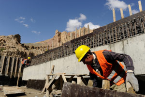
![The Mahadeo, one of the ten rivers that may be added to the list [image by Abu Bakar Siddique]](/wp-content/uploads/2016/10/Pic-01_Mahadeo.jpg)
Some of the major transboundary rivers between the countries are Ganga, Brahmaputra, Teesta and Surma-Kushiara. Bangladesh is the downstream country for all these rivers. The upper riparian countries are India, Bhutan, Nepal and China. Out of 1.72 square kilometres of catchment areas of these rivers, Bangladesh has 7%, and receives 1.5 billion metric-tonnes of sediment every year through its river systems, according to the JRC.
Malik Fida Abdullah Khan, deputy executive director of the Centre for Environmental and Geographic Information Services (CEGIS), who led the recent study to identify transboundary rivers, said, “We have finalised the list and sent [it to the Commission].”
Mohammed Mofazzal Hossain, the Bangladesh director of JRC, said, “At this moment, we are verifying the rivers’ status, and after that we will send the names to the Ministry of Water Resources to get an approval of the rivers as transboundary. Thereafter we will propose them in joint meeting between Bangladesh and India.”
The process will take time as there are different procedures, and finally, the decision will come jointly from the two countries, he added.
Importance of recognising common rivers
Former member of JRC in Bangladesh, Ainun Nishat, said, “By recognising a river between two countries, each country can get information on a certain river from the other. The information might be on riverbank erosion, pollution or navigability. Later the information helps the managers to take proper actions in river basin management.”
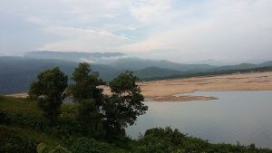
![Bangladesh's shared rivers [image by the Joint Rivers Commission, Bangladesh]](/wp-content/uploads/2016/10/JRC-shared-rivers.jpg)
In addition, joint planning for dredging in Ichamati river located on the border of India and Bangladesh is also an outcome of having the river marked as a transboundary one by the JRC. Nishat added, “To get proper information about a river system and use that for managing the river’s basin wisely, all common rivers should be identified and recognised [by the countries sharing the river].”
Apart from this, with data support from India, Bangladesh has improved its flood forecasting systems from five to ten days – although this is still at an experimental stage. India now shares information on water levels at eight points along the Brahmaputra, Teesta, Ganga and Barak rivers during the monsoon with Bangladesh. Two water flow measuring stations are on the Ganga, one on the Teesta, four on the Brahmaputra, and one on the Barak. All the flow counts are measured within 200 kilometres of the international border.
History of JRC and transboundary rivers
In 1951, two rivers – the Teesta and Ganga – were discussed between India and East Pakistan (which became Bangladesh in 1971). In 1952 the Brahmaputra was also brought into the discussion. A year after the independence of Bangladesh from Pakistan in 1971, India and Bangladesh set up the Joint Rivers Commission to exchange information on the river basins and cooperate over their management. Until the 1980s only three rivers were recognised as “common” rivers. In 1982 Bangladesh proposed six other rivers – the Sangu, Muhuri, Khowai, Gomti, Dharla and Dudhkumar to be formally recognised as transboundary rivers.
Slowly this number has been expanded to the current officially recognised 54 rivers.
As the lowest riparian country in the Ganga-Brahmaputra-Meghna river basin, Bangladesh gets most of the silt that rejuvenates soil fertility, but also experiences the worst of the adverse impacts – floods in the monsoon and droughts in the dry season. Riverbank erosion as well as pollution in upstream countries affects Bangladesh.
For Bangladesh the identification of transboundary rivers, and their basin wide management, is of critical importance, but it is also in the interest of the other countries, even if they are affected in less direct ways. Malik Fida hopes that they can work together to manage the challenges.