Ahmad Din, or Ahmati as the forty-something shepherd is known around the village, is somewhat of a hero these days.
Living atop the mountain surrounding Reshun Village in Pakistan’s Chitral district, Ahmati heard a loud rumble above him on the night of July 31, and knew something terrible was going to happen. He wasted no time in sending a warning – a signal by his torch followed by screaming – to those living in the valley below.
This primitive early warning system saved an estimated 7,000 lives in the village. They would otherwise have been annihilated by the flash floods that came that night. But Ahmati lost everything to the deluge – his two-year-old son, four-year-old daughter and his little home. He lost his means of livelihood – a dozen or so goats. His wife survived the calamity, though she was badly hurt.
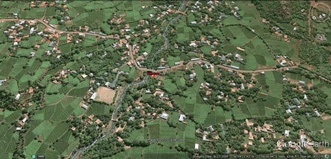
Situated 1,897 metres (6,225 feet) above sea level, Reshun valley has eight small and big hamlets. Chitral is the largest district in the province of Khyber Pakhtunkhwa (earlier called North West Frontier Province), in the Hindu Kush Himalayas.
While loss of life was minimal, as people fled their homes in the nick of time, damage to infrastructure was considerable. Pedestrian bridges collapsed, though damage to hydroelectric power stations, irrigation channels, drinking water schemes and electricity transmission lines was partial. But perhaps the greatest cost for the villagers was that hundreds of acres of standing crops and orchards were washed away.
As for what caused the floods, this is currently being debated within the scientific community. Hamid Mir, the manager of the Pakistan GLOF-Project, is certain a glacial lake burst, caused by “a heat wave”. With as many as 542 recorded glaciers, the region has a long history of glacial lake outburst floods (GLOFs).
According to Mir, the lake outburst was triggered by a sudden rise in temperature during the last two weeks of July. “If you compare the mean temperature in Chitral in the last three years, you will find these have increased by two to three degrees Celsius,” he said. “At the same time, the precipitation has just been four millimetres, which is insufficient to cause such massive flooding.
“I have travelled extensively in this mountainous region and I have myself witnessed about two dozen glacial lakes, but I am sure there are many more inside the glacier, which are not visible and waiting to burst with a slight increase in temperature,” he said.
“In the last 12 years this region has experienced more than eight glacial outburst floods in different valleys,” he told The Third Pole in a telephone interview from Chitral
Bashir Ahmed Wani, former inspector general of forests in Pakistan, went to study the impact of the recent flash floods on biodiversity in the area. Though unsure if the flooding was due to a glacial lake outburst, Wani agreed with Mir that climate change played a big part in causing flash floods.
Wani said monsoons were a phenomenon unheard of at such heights in the past. But they were now reaching as far up as Chitral. “I spoke to the people in the met office in Chitral and they told me they had measured (an increase in) humidity in that region.”
But Mir ruled out rainfall as a trigger for the flash flood. He said Chitral had a dry and temperate climate, and got its major share of rain in winter.
This western region of the Hindu Kush Himlayas had also experienced half a dozen earthquakes of varying magnitude in July.
“In a fragile ecosystem like Chitral’s these seismic activities can lead to GLOFs,” agreed Wani. “These are fairly young mountains; the hot molten matter and sudden jerks and tremors cause uplifting of the mountains stirring the glaciers and the water of the basal lakes inside them to find its way out.”
“The glacial ecosystem is extremely fragile and landslides can occur because of the temperature, slope, size and amount of melt-water in the glacier,” Wani added.
He also observed that the devastation due to the flash floods was exacerbated due to indiscriminate and poorly planned development, overgrazing and deforestation over many years. Further east in the Himalayas, the state of Uttarakhand in India had suffered for exactly the same reasons this June.
Mir said that when development work is undertaken, the environment is hardly ever given a thought. “Perhaps this should now be done in a more regulated way, so as not to disturb the fragile ecology,” he said.
The Gilgit Baltistan region in the Hindu Kush Himalayas has an estimated 5,218 big and small glaciers. As many as 2,420 glacial lakes have formed, 52 of which have been declared “potentially dangerous” by the International Centre for Integrated Mountain Development (ICIMOD). Yet Pakistani authorities do not have an accurate early flash flood warning system in place there.
According to Kanwal Waqar, research officer at ICIMOD’s Pakistan office, the government is resource-stretched when it comes to investing in scientific technology. “As long as it is supported by the private sector, data collection continues smoothly; but the moment a project concludes, the flow of data stops,” she told The Third Pole over phone from Islamabad. Recently, with the help of UNDP and ICIMOD, the Pakistan Meteorology Department (PMD) has installed an early warning system in Bagrot valley in Gilgit.
Mir said before solutions can be found, there was a need to carry out a detailed survey and have an inventory of glaciers and understand the geology of the region to be able to make informed decisions. “It’s quite doable. The indigenous people have lived here for centuries and the knowledge passed on through generations is invaluable.”
But, said Waqar, the PMD already had an inventory and there was no need to carry out such a survey. What was needed, instead, was to work on adaptation and mitigation. “The communities are not very forthcoming when it comes to adaptation, but they can be taught to handle the early warning system apparatus.” In addition, she was pleased with the recently developed programme of evacuation of communities developed by the government.
Mir said it was imperative to invest more in weather watchers and meteorology. “We need to set up at least four met stations that can tabulate climate data in the upper Chitral. The elevation and topography here is such that temperatures vary every few thousand feet. This is not a very expensive venture, nor does it require very sophisticated equipment since the rain gauge, barometers and anemometer are all locally available in Pakistan; however, we may need to buy imported thermometers.”
Zofeen T Ebrahim is a freelance journalist based in Pakistan.


