
Flowing from the headwaters in Tibet, the Salween traverses China and Myanmar and defines part of Thailand’s western border. Stretching over 3,200km (2,000 miles), it is Asia’s longest free-flowing river, running from the Three Parallel Rivers of Yunnan province in south-west China to the delta near Mawlamyine in south-east Myanmar, where it meets the Andaman Sea.
However, plans for seven major hydropower projects along the Salween basin threaten this status. They have also been a constant source of contention, particularly in the Salween’s northern reaches. In February 2021, the military junta took control of Myanmar, ending cross-border cooperation to protect the river across the Myanmar, China and Thailand borders.
Amidst this upheaval, we assess the status of the dams and examine the stakes involved, particularly regarding the wildlife and communities at risk of displacement.
What wildlife does the Salween River support?
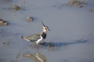
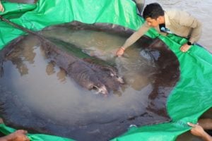
The Salween sustains a rich ecosystem, hosting over 200 species of fish, more than a dozen of which are endemic. Additionally, some migrate from the Indian Ocean to the river’s upper reaches, adding to its ecological diversity. The basin is believed to house nearly half of China’s animal species, including sun bears, leopards, pangolins and black snub-nosed monkeys. The river also boasts the world’s greatest biodiversity of turtles and numerous bat species.

Why is the Salween River important?
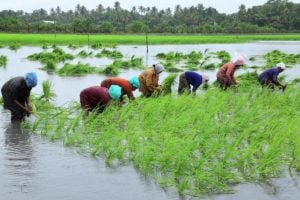
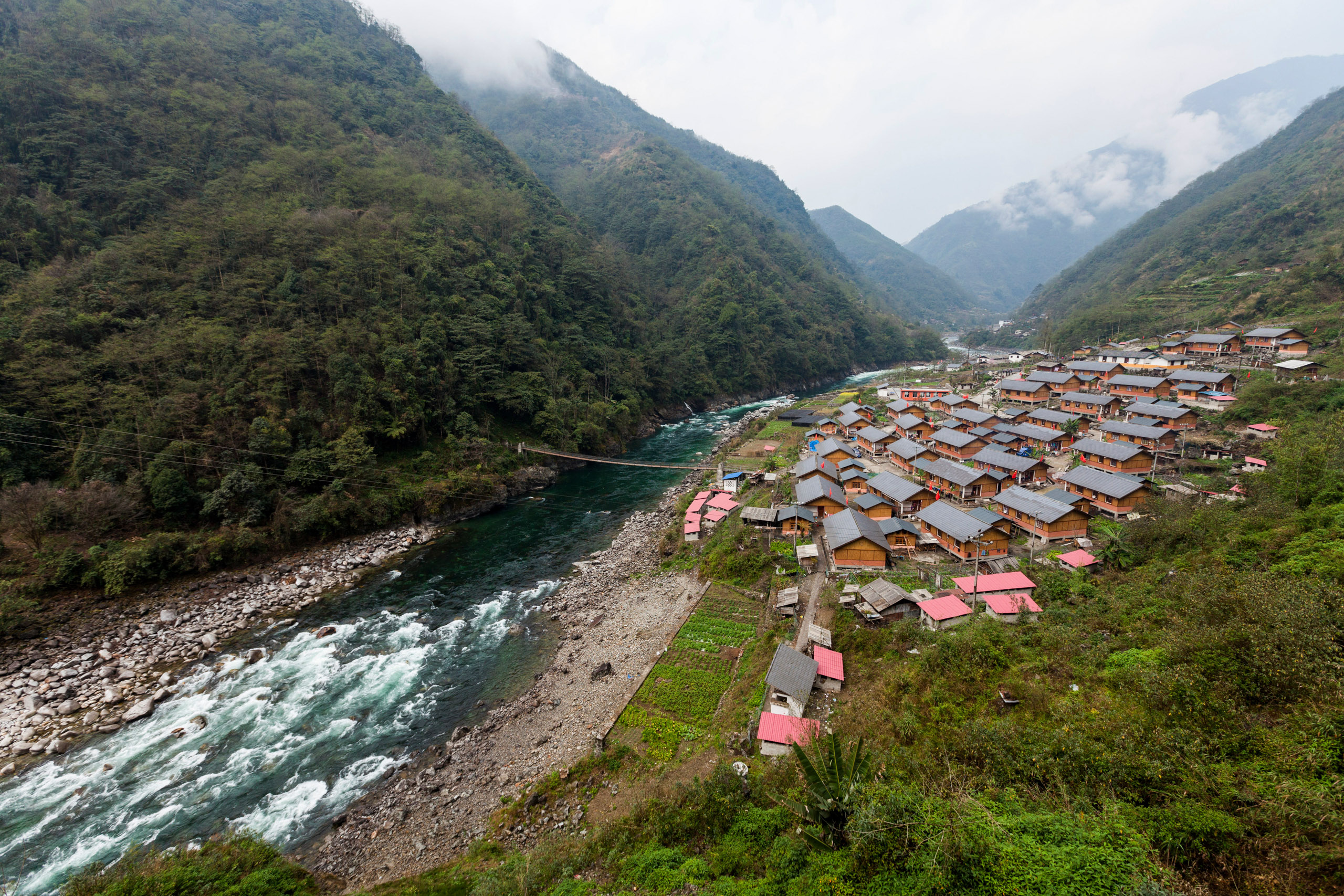
The Salween basin, which spans over 320,000 square kilometres, is the second-longest river in Southeast Asia after the Mekong and supports over 10 million people. Entering Myanmar in the northeast, it flows through rural and agrarian areas, as well as the densely populated Mon State and its capital Mawlamyine, sustaining fisheries and agriculture.
As a free-flowing river, the Salween provides unique habitats for beach-nesting birds and migrating and wintering water birds. The Three Parallel Rivers section in Yunnan is a Unesco World Heritage site recognised for being possibly “the most biologically diverse temperate region on earth”, along with its natural and geographical features.
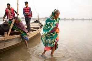
The Salween, which is also sacred to its Indigenous inhabitants, flows through some of Myanmar’s most politically turbulent regions. Since the coup, conflicts between ethnic armed organisations and the military have intensified, centred around control of the river, its resources and people.
What dams are planned for the Salween River?
While large hydropower projects have been planned for various stretches of the river for decades, no dams have reached completion along the Salween mainstream. Yunnan provincial authorities halted plans for 13 hydropower projects in 2016, with plans to turn the area into a national park. But in Myanmar, seven dams, involving Chinese and Thai companies, are in various stages of planning and construction, all with no known completion dates.
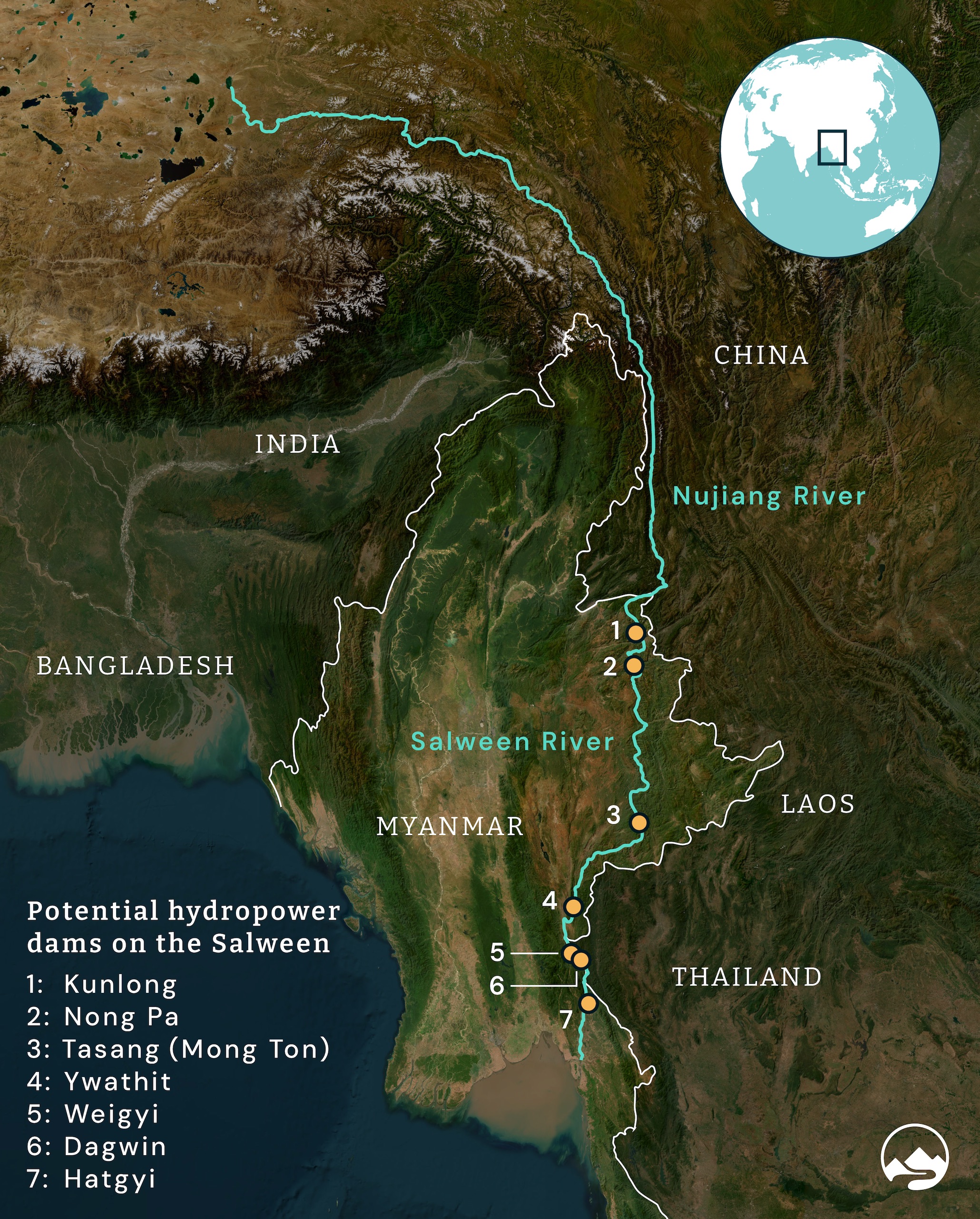
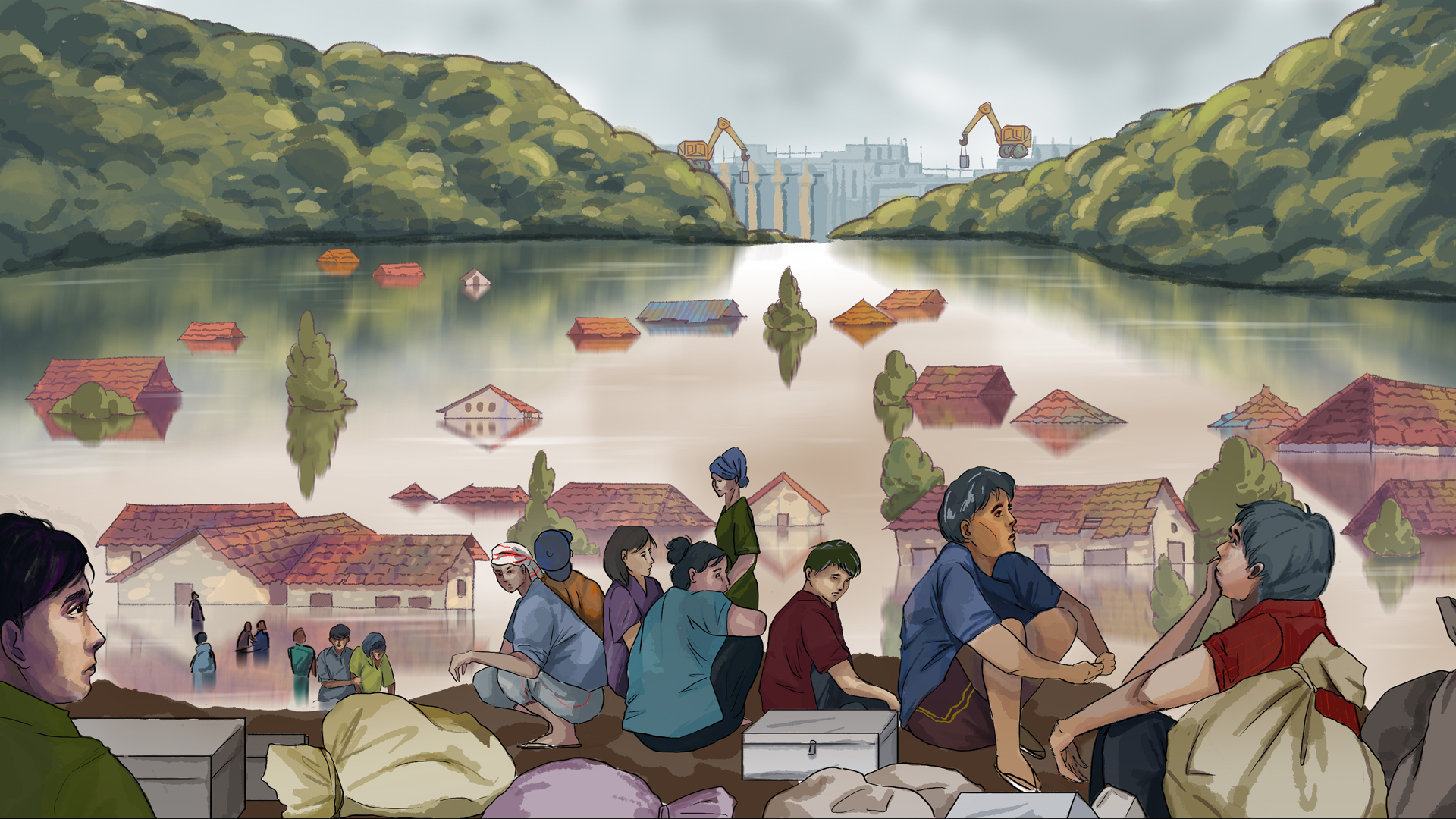
Three of the largest dams – Tasang, Hatgyi and Weigyi – are the most contentious. The Tasang, also called Mong Ton, is Myanmar’s largest proposed dam. Development of the 7.1-gigawatt, 230-metre-tall dam has already resulted in the forced relocation of 300,000 people in northern Shan State. The Electricity Generating Authority of Thailand (EGAT) and China Three Gorges Corporation broke ground in 2007 with some early-stage construction, which has since stalled.
The Hatgyi and Weigyi dams have moved forward slowly under Myanmar’s junta. Located in southeastern Kayin State, in the Salween’s lower reaches, building of the 1.3-gigawatt Hatgyi dam – a collaboration between EGAT and Sinohydro International – has made progress under General Min Aung Hlaing’s regime. Construction has led to unrest, including forced relocations by Border Guard Forces and military clashes in 2016 before the coup, involving the since-disbanded insurgent Democratic Karen Buddhist Army.
Of particular international interest is the Weigyi dam, financed by Thailand and contracted to Power Construction, China Southern and China Three Gorges Project Corporation. This is due to cross-border implications: the 4.5-gigawatt-capacity dam is located on Myanmar’s border with Thailand. However, environmental advocacy has become challenging under the military regime, with academics and activists expressing safety concerns.
Plans to proceed with smaller dams like Ywathit, Kunlong and Nong Pa could also exacerbate tensions, as evidenced by clashes over land clearance for the Ywathit dam. After initial land clearance for Kunlong dam in 2014, work has stalled.
What tertiary projects may affect the Salween?
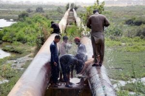
China’s plans to dam the Salween (where it is called the Nujiang) have been replaced by the establishment of the Three River Source National Park. Meanwhile, in Thailand, hydropower projects on the river’s tributaries are altering its flow. The Yuam River Diversion aims to divert its namesake major Salween tributary to irrigate the central plains of northern Thailand with 1,795 cubic meters of water annually.


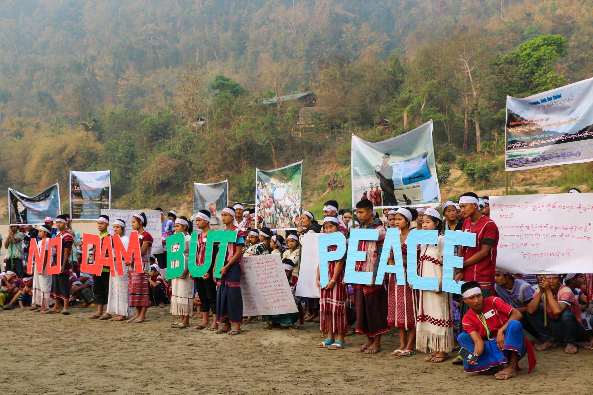
NGOs in Thailand and cross-border organisations like the Salween Peace Park oppose the US$1.9 billion project, which cuts through five national forest reserves and Mae Ngao National Park.
Although the Salween mainstream remains undammed, its tributaries face development. Dam projects on the Baluchang River have been ongoing since 1950, with three large dams in Karenni State and one on the Teng River operational since 2009.
How might hydropower and other infrastructure projects damage the Salween River?
The Salween’s natural rhythm, dictated by annual snowmelt and monsoon rains, sustains a delicate balance crucial for species. Hydropeaking from dams, whereby bursts of water are released to increase power at peak times, risks inundating nesting sites and disrupting habitats vital for various species.
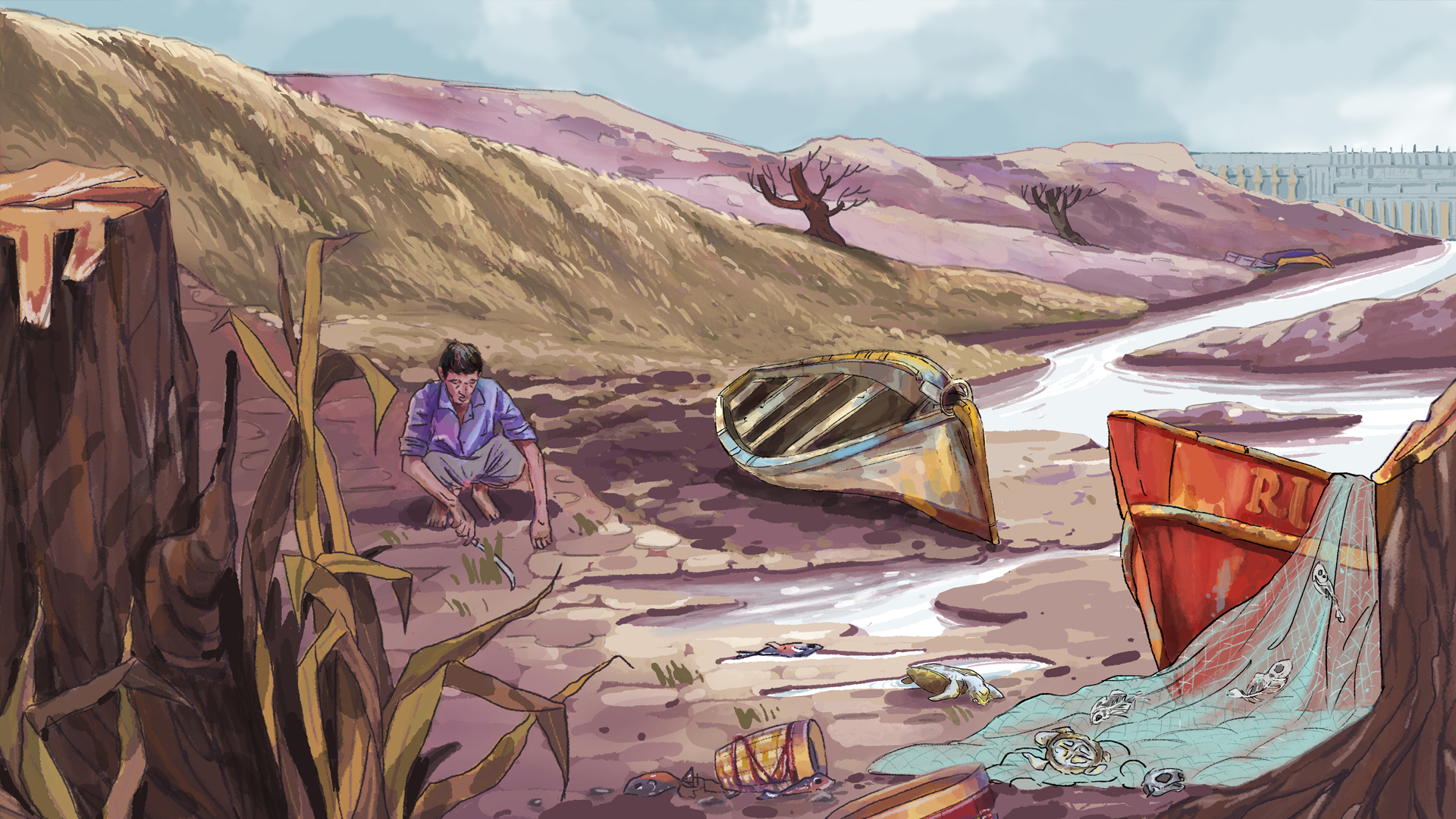
New dam construction could disrupt fisheries, hindering animal migration routes and creating standing water and exacerbating pressure changes, injuring and disorientating marine life. This jeopardises shoreline fishers’ livelihoods, compounding problems posed by overfishing and pollution. Dam construction may also diminish sediment flow vital for lower-reach ecosystems and agriculture, such as with the Xayaburi dam on the Mekong.
Limited research on the river’s lower reaches obscures potential impacts from upstream developments. Unlike the Mekong, the Salween lacks robust data and cross-border cooperation mechanisms, like the Mekong River Commission, complicating efforts to address these threats effectively.
How has Myanmar’s military junta changed the Salween?
Following the coup, civil society has been severely restricted in the region, impeding cross-border cooperation efforts. This has likely exacerbated illegal mining, sand mining and deforestation.
The Karen-led Salween Peace Park, a 567,000-hectare protected conservation area established in 2018, has since faced airstrikes, violence and a growing migration crisis. Suspicion of foreign interference has resulted in funding cuts and endangered environmental workers.
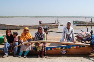
Even before the coup, dam construction sites were hotbeds of conflict and human rights violations, with grassroots organisation Karen Human Rights Group citing instances of violence around the Hagyi site between 2014 and 2018. Armed conflict in the region, which has been difficult to gauge since the coup, has led to an estimated 2.6 million displaced people across Myanmar as of end-2023.
Dam construction would flood villages, forcing people to resettle, contributing to migrant influx across the Salween into Thailand, as people flee landmines and potential violence in Myanmar.
How are countries outside Myanmar influencing mainstream dams on the Salween?
Along with the Yuam River Diversion project, Thailand’s EGAT is involved in developing the Weigyi, Hatgyi and Dagwin dams, with the goal of selling and purchasing power from them, while Chinese companies have interests in projects including Hatgyi, Ywathit, Tasang, Nong Pa and Kunlong.
Criticism has been directed at Thailand for power purchase agreements with dams in Laos and Cambodia, given its energy surplus in recent years. Up to 90% of power generated by the Tasang dam is expected to be sold to Thailand and China.

China’s influence extends beyond energy, with involvement in border conflicts, including along the Salween. Despite the military junta’s tight grip on civil society, recent developments, such as Operation 1027 in October 2023, saw the government pushed back from over 400 bases in northern Myanmar. A fragile ceasefire in Shan State in January 2024, brokered with Chinese assistance, indicates China’s role in regional stability efforts.