![<p>The heavy traffic on NH-58 has made life difficult for the large animals of Rajaji National Park [image by: Rishika Pardikar]</p>](https://dialogue.earth/content/uploads/2019/06/Elephant-corridor-1-300x225.jpg)
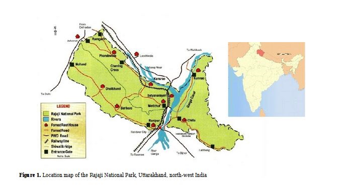
The Rajaji National Park, named after independent India’s first governor general, sits between the Shivaliks and the foothills of the great Himalayan range. The Shivaliks, extending from the Indus to the Brahmaputra, with the Ganga cutting through them, are part of the outer range of the Himalayas, rising to a height of 1,200 metres, and at times only 16 kilometres wide.
Originally the name of the Shivaliks was reserved for a region of 320 kilometres, not accounting for the range extending into the east. It is in this area where the Rajaji National Park is located, with a core area of 820 square kilometres, and an extended area of more than 1,100 square kilometres once its buffer area is also considered.
The reserve is home to some of India’s most endangered species, including hornbills, otters, gorals, leopards, tigers, and elephants. Unfortunately the future of the reserve may not be dependent on its ecology alone, but how human intervention is shaping it.
Tigers in the east, almost none in the west
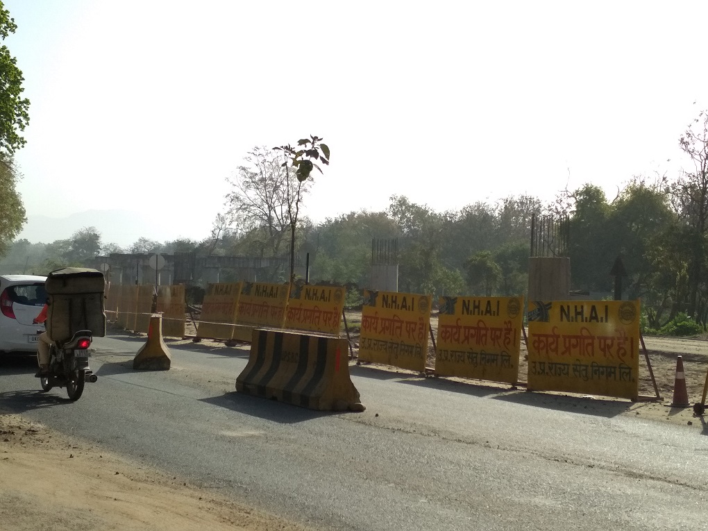
One of the biggest issues has been the disturbance caused by the work on National Highway 58 and the Haridwar-Dehradun railway line that cut through the reserve. Originally meant to be finished in 2013, the highway has still not been officially completed struggling with issues of land acquisition. But the areas completed through the park – which did not require the government to deal with local farmers to acquire their land, and which could be widened by the government unilaterally, have had their impact. Tigers have practically disappeared from the western part of the park, although it accounts for about a third of the area.
Bivash Pandav, a scientist at the Wildlife Institute of India says that his team had conducted ad hoc camera trappings in 1996 and 1999 and found many tigers in the Dholkhand range. But by 2006, there was a complete decline in tiger population and only three female tigers remained. From 2012 the area has been home to just two tigers.
“We have photographed about 70 tigers over the past 15 years in eastern Rajaji and none of them moved to western Rajaji”, Pandav explained.
The skewing of tiger distribution is troubling because connectivity between forested landscapes is important for genetic exchange that could ensure the long-term survival of the species as a whole. India hosts the vast majority (2,226) of the remaining 3,890 tigers in the world, most of them in its national parks.
The other species that has been affected by the highway and railway line is the elephant. Harihar explained that while male elephants manage to move across the two sides of the reserve, such movement among females is “limited.” He also noted that wildlife movements are not being documented currently, and it is probable that this is leading to gaps in understanding the threats that liner infrastructure projects tend to pose.
It is not just the road and railways that have divided the park. The Chilla Hydroelectric Power Station located in the eastern half of the reserve further fragments the landscape. Harihar said that in the 1970s, the habitat along the Ganges used to host massive elephant congregations. “But since the hydro project came in, access to the river was restricted and these congregations stand reduced now.”
The combination of road and railway on top of this old division has had a large impact. In a paper published in 2015 in Biodivertisas, Riten Joshi wrote, “Since last 15 years, vehicle’s traffic pressure on two national highways (Haridwar-Bijnor and Haridwar-Dehradun) has increased almost two folds and elephants were observed not in the situation to cross the road easily, especially during evening hours.”
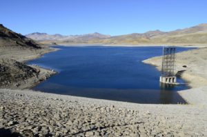
Water is being sucked out
The other imminent threat that Rajaji faces is water shortage. Sargam Singh Rasaily, member secretary of the Uttarakhand Biodiversity Board who authored the Management Plan of Rajaji National Park said that State Infrastructure & Industrial Development Corporation Uttarakhand Ltd (SIDCULL) is located just outside the boundaries of Rajaji. The amount of water that these manufacturing plants draw from the water table is increasingly becoming a burden to the reserve.
“Problems like water shortages are all the more reason to conserve the Rajaji forest because it is the main sink area where ground water gets recharged,” he argued.
The reserve falls largely in a region called the Bhabar tract, which lies at the foothills of the Shivalik range. It plays a key role in the absorption of rainwater. Such absorbed water then flows to the Terai tract where it gets collected and is eventually used by the large agricultural fields, industrial areas and human settlements located in and around the region. Thus the Rajaji reserve is “the main water tower” in the area Rasaily explained. Conserving the ecosystem of the reserve, therefore, is key to sustaining life and livelihood along the Shivaliks.
The drop in water availability has a large effect on the wildlife, not only does it lead to less grassland – forcing large elephant herds to become smaller – but as Joshi notes in his paper on elephant populations, “In between 2007-2009, tremendous wildfires destroyed the natural forest in Haridwar and Chilla ranges and adjoining habitats.” Drier areas become particularly vulnerable to these threats, and so do the fauna that inhabit them.
Human wildlife conflict
Lastly, there is the presence of human settlements within the boundary of the reserve area. Pastoral tribal communities, locally known as Gujjars, live in both the Gauri and Shampur areas. Gauri is located north of Chilla and is part of the core area of the reserve while Shampur is located south of Chilla and is part of the buffer zone.
The Chilla range is inviolate and has a healthy tiger population. But Pandav explained that when tigers are born in the Chilla range and eventually disperse into the Gauri and Sampur areas, “they are not able to survive there.” Some of this is due to the human-wildlife conflict, with the buffaloes that the villagers herded being natural prey for tigers.
Tigers are forced to go into sub-optimal habitats like Gauri and Shampur – where they then end up in conflict with these human settlements – because of the lack of connectivity between the eastern and western halves. Pandav suggested that Gauri and Shampur areas should be made inviolate so that tigers live and breed there and there is a pressure on these tigers to then move west.
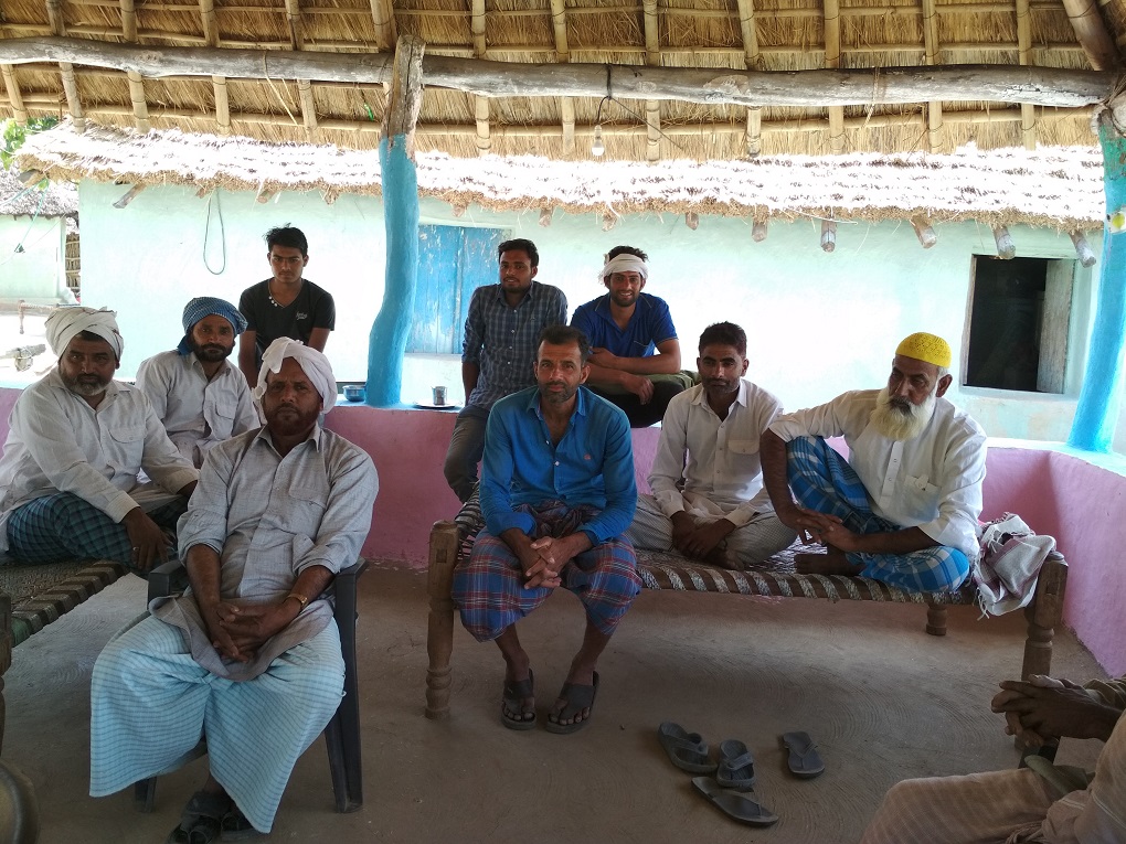
This was backed up by this reporter’s interactions with these communities who specifically reiterated their willingness to move out of the reserve if they could be rehabilitated on other land.
Nevertheless this human presence, and the resultant human-wildlife conflict, is secondary to the main problem of connectivity. Harihar reiterated that without improving connectivity between the two halves, “we cannot expect tiger populations to improve.” In fact, Joshi’s paper on elephant populations in Rajaji National Park, and the resettlement of Gujjars, indicated that the latter had minimal impact on elephants. The significant difference is, though, that elephants do not prey on cattle.
Cut apart by infrastructure projects that ignore the needs of the unique fauna within the tiger reserve, the Rajaji National Park is now half the sanctuary it could be. With water drying up, and being sucked out from the water tower of the area, the ecosystem that the wildlife preserve was set up to maintain is increasingly under threat, and its unique wildlife, even more so.
With additional inputs by Omair Ahmad