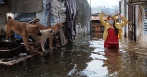
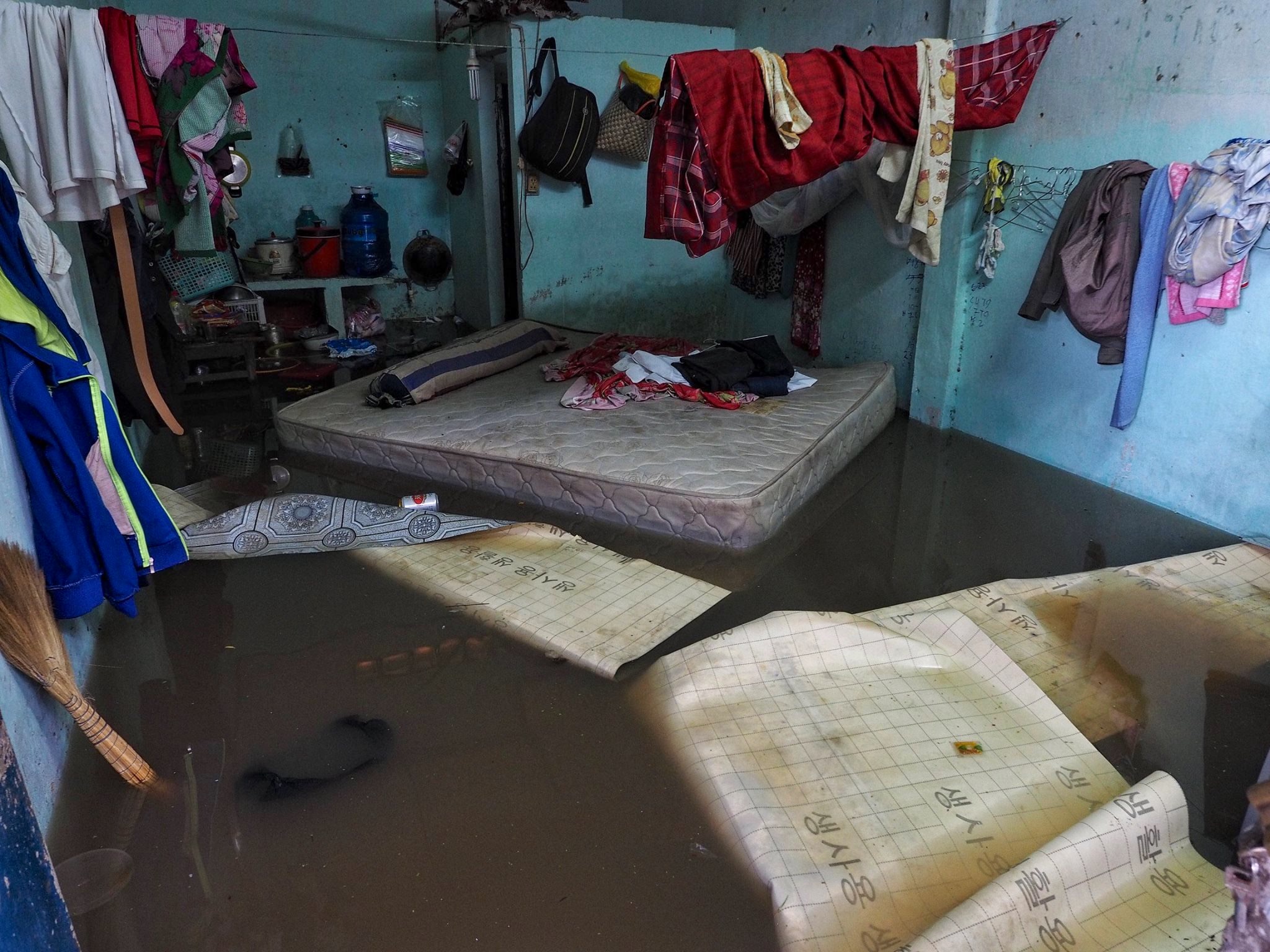
In April this year, in the first downpour of southern Vietnam’s rainy season, the narrow rented room where Ma Thi Diep and her children were staying in Ho Chi Minh City was inundated by knee-high water.
“It flooded in from the street and came up from the drain in the bathroom. We couldn’t stop it,” recalls the lottery ticket vendor. “The liquid was black like coal and so stinky I almost fainted.” The water subsided after two hours, and the family cleaned the room until midnight. “My skin got itchy a bit, and it’s lucky we don’t have anything too valuable to get damaged,” she adds, half-jokingly.
Originally from Vietnam’s southern province of Soc Trang, Diep’s family – and many other migrants among Ho Chi Minh City’s 9.4 million residents – live in District 12, to the north of the city centre. Despite lying on the higher and supposedly drier side of the city, District 12 has become one of its most flood-prone areas in recent years. Generally it is Ho Chi Minh’s outskirts, predominantly home to migrants and lower-income households, that suffer the highest rates of subsidence and flooding.
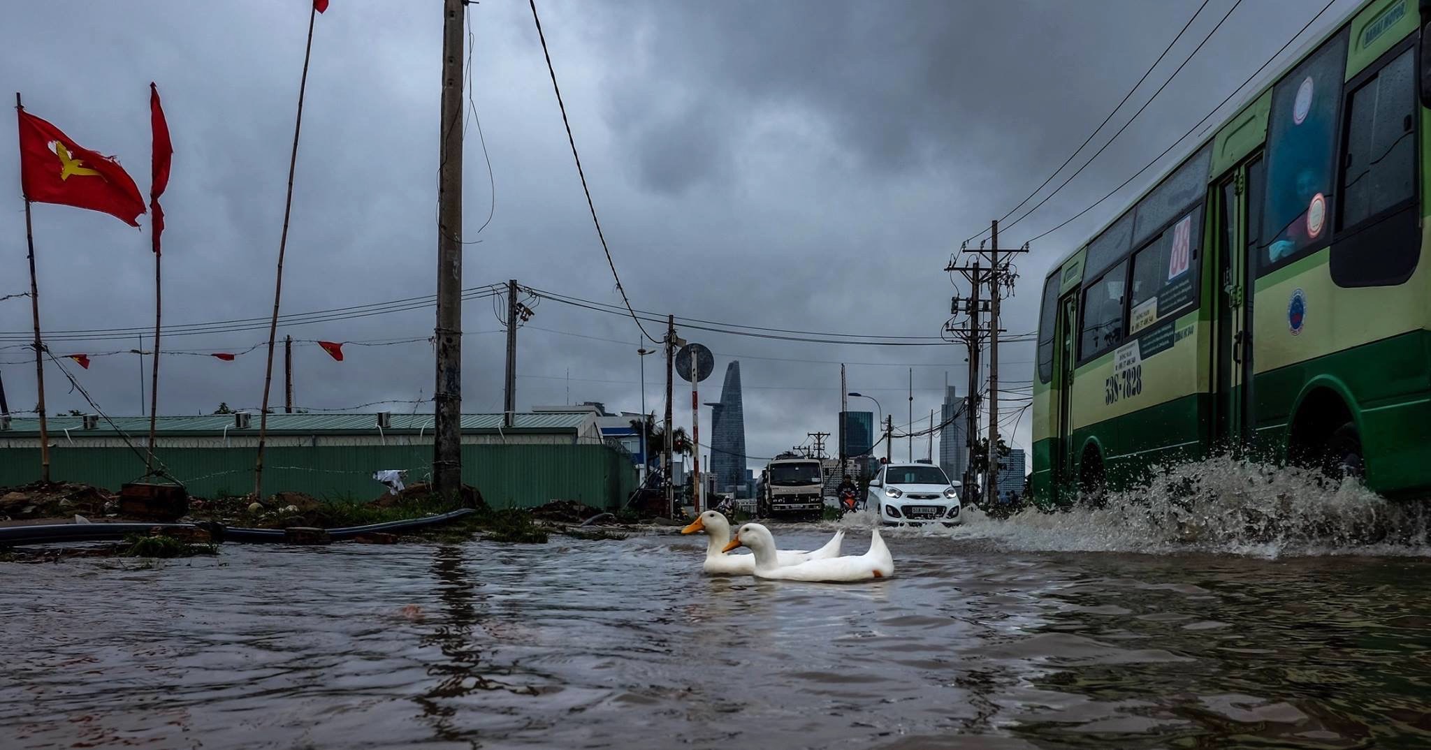
The 2023 rainy season began a month earlier than usual in southern Vietnam, arriving in April. Heavy bursts of rainfall in which 100 mm of water fell in one hour used to happen around once every five years last century, but became a daily occurrence in June and July this year, according to local authorities. Research anticipates that heavy rainfall will inundate the city’s underdeveloped drainage system more regularly in the coming decades.
These extreme weather trends feed into a worrying wider picture. Ho Chi Minh City is one of the world’s fastest-sinking coastal cities, alongside Tianjin and Shanghai in China, and Semarang and Jakarta in Indonesia. The city is also at increasing risk of substantial flooding from rising sea levels: a one-metre rise would be enough to submerge a fifth of the city by 2100, according to a 2020 government report.
The economic engine of southern Vietnam, Ho Chi Minh City produces 22% of the country’s GDP. Chronic flooding is currently estimated to cost the city USD 1.3 billion annually, rising to USD 8.7 billion – or 3% of GDP – by 2050.
“It is a city built on water,” says Nguyen Hong Quan, an expert in environmental hydrology and climate change at Vietnam National University. “And now it is put in front of a new set of changes. Without proper planning, more severe flooding is certain in the future.”
Infrastructure outpaced by urban sprawl
Long-time District 8 resident Nguyen Tan Loi says this swampy region was covered by rice fields and fish ponds until the early 1990s. It has since been built over with university campuses and residential wards. “The city’s surface is now mostly paved by concrete, with little open soil for the water to seep into,” says Hong Quan. “[Rainwater] is flushed into the outdated sewers, which can hardly handle it and eventually spill it out back to the street.”
In the city’s southern reaches, Nguyen Trung Hieu and his neighbours also face inundation. His neighborhood in District 8 – one of Ho Chi Minh City’s poorest districts – is flooded twice a month between September and February by the Ba Tang canal that runs through it. “The tides get higher and higher, by roughly 5cm a year,” he says. Hieu has raised his floor “a few times already” and the residents have all paid towards work to raise their shared road.
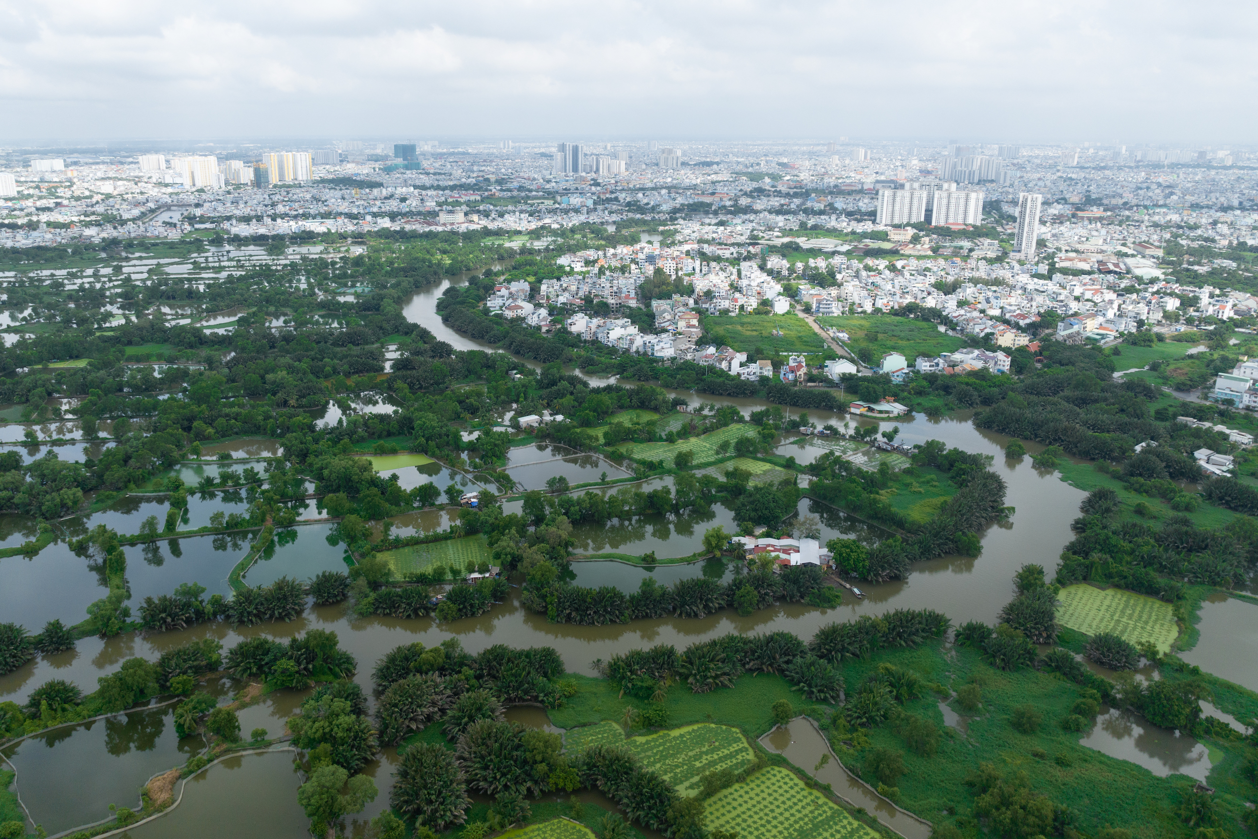
Nearly half of Ho Chi Minh City’s area lies less than one metre above sea level. It is also criss-crossed by a network of tide-influenced rivers and canals that covers approximately 21% of the city. This network is one reason why the city has been an important trade port for the past two centuries for ships carrying agricultural goods from the Mekong Delta and other areas of southern Vietnam. Following the war in the 1960s-70s, it became the country’s manufacturing and financial hub.
This explosive economic growth came with rapid urbanisation, stacked mostly upon soft, alluvial soil. Plumbing infrastructure was slow to catch up to the urban sprawl, so groundwater extraction using makeshift wells became widespread. Thousands of these wells remain in Ho Chi Minh City, pumping groundwater for industrial, domestic and agricultural uses. Where extraction of groundwater exceeds the rate at which it can be replenished, this can cause the water table to lower, and the ground above it to sink.
Between 1991 and 2015, Vietnam’s wider Mekong Delta area sank by an average of approximately 18cm during those 24 years; a 2017 study found groundwater overexploitation to be the main culprit. The gradual subsidence of this area is forcing the poorest inhabitants with the least amount of land to migrate, most likely to Ho Chi Minh City and adjacent industrial hubs.
According to a 2015 study, Ho Chi Minh City itself subsided by an average of 8mm per year during 2006-2010. The most severe levels of subsidence, reaching 70mm per year, were noted in the city’s eastern outskirts, along the Saigon River. Following municipal efforts to reduce groundwater extraction and defend against sea-level rise, a 2020 study found that subsidence levels had improved to between 3.3mm and 53mm per year during 2017-2019. However, the fastest subsidence rates were still to be found in the city’s outskirts. Meanwhile, rising sea levels are projected to displace 78% of Ho Chi Minh City’s inhabitants by 2100.
Disproportionate impacts on Ho Chi Minh City’s residents
A 2016 World Bank study found that Ho Chi Minh City’s slums (“densely built small households and shelters that have [a] predominantly semi‐permanent character”) are disproportionately exposed to the consequences of flooding, with 68‐85% being at risk, compared to an average of 63-68% across all of the city’s urban areas.
Ho Chi Minh City is Vietnam’s strongest migration magnet, but the city’s environmental challenges tend to exacerbate the problems faced by many newcomers. “We found migrants were initially healthier than non-migrants, but then their health declined really quickly over time,” says Hang Ngo, a public health research scientist. Last year, her research into migrants from the Mekong Delta found that most live in small, poorly ventilated dwellings with substandard hygiene conditions. If these dwellings are in flood-prone areas, the risk of dengue fever and skin infections increases.
Le Van Loi, a garment worker by day and motorbike taxi driver by night who lives in Binh Chanh District on Ho Chi Minh City’s western outskirts, tells The Third Pole that floods are his biggest fear: the waters can knock over drivers, while fixing a waterlogged bike costs more than VND 150,000 (USD 6). “Not worth it for a few dollars’ ride,” says the 29-year-old. During particularly rainy spells, Loi’s income drops substantially.
Crucially, the city’s low-income and migrant populations, who tend to live in areas of high flood risk with underdeveloped local infrastructure, usually have fewer resources to protect them from flooding. “It is like a vicious circle,” says Cao Vu Quynh Anh, a University of Tokyo researcher who has studied how Ho Chi Minh City residents cope with floods.
Grey, green and communal problem-solving
The Vietnamese government is currently betting on engineering to hold back the water in its biggest city. But progress so far has been slow. For example, a drainage infrastructure project for the city was proposed in 2001, but 20 years later, its construction was less than 50% complete. Another project, which seeks to protect a 570 sq km area encompassing the city centre with ring dykes, sluiceways and water pumps, is currently behind schedule. Insufficient interest in such projects from both city authorities and private investors is reportedly a factor in these delays.
Critics have pointed out that these flood defense projects are too limited in scope however, because they are mainly concerned with the old, central areas. Ho Chi Minh City’s urban sprawl is outpacing protection plans. “These ‘grey’ solutions may help soothe the flooding problems, but they are not enough,” says Hong Quan.
According to research published in June 2023, the deployment of “small-scale rainwater detention measures” (also known as the ‘sponge city’ approach) would be beneficial in Ho Chi Minh City. Such measures would include installing green roofs, rain barrels, porous sidewalks and water-detention basins. The research found that these smaller-scale, fragmented measures are a “highly complementary adaptation pathway” when deployed alongside large-scale engineering interventions.
Quynh Anh says the city is following the same reactive adaptation approach as other Asian coastal cities like Tokyo, Jakarta and Manila. This approach means “fewer choices of measures are left and time is very tight for any solution”, she says.
According to both Hong Quan and Quynh Anh, Vietnam’s most populous city currently lacks a comprehensive flood-mitigation plan that connects solutions together. But for such a plan to materialise, Quynh Anh says “better communication between the city and its people” is essential. “Understanding is very important. It helps the city to come up with more applicable adaptation plans, and the residents can be proactive in coping with flooding.”
Meanwhile, both Ma Thi Diep and Nguyen Trung Hieu are running out of solutions. Diep has moved her family to a new neighbourhood on higher ground, but she says she cannot afford a more expensive room if this one floods. And Hieu knows the tide will keep climbing, but he cannot keep raising his home: “If we lift the floor any higher, it will touch the ceiling.”