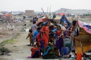
When water levels rose in a tributary of the Koshi river during the 2019 monsoon, villagers of Launiya in Nepal’s southern district of Saptari, banded together to form a makeshift human embankment. They lay on the ground next to each other all night – shivering and terrified –desperately trying everything to stop the flood waters from entering their homes and farmlands. Forecasts and early warning were available, but these could not be translated into an effective response.
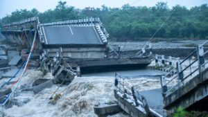
Across the Hindu Kush Himalayan (HKH) region, spanning Afghanistan in the west to Myanmar in the east, disasters like Launiya’s are becoming increasingly common. As last month’s report ‘Water, Ice, Society, and Ecosystems in the Hindu Kush Himalaya’ by the International Centre for Integrated Mountain Development (ICIMOD) makes clear, these events are likely to become even more frequent and intense due to climate change. Early-warning systems have provided some success, but they are only a piece of a larger, complex puzzle. Timely and actionable information does not always reach those who need it most; when it does, many people receiving the early warning find the information either too generic or too difficult to understand.
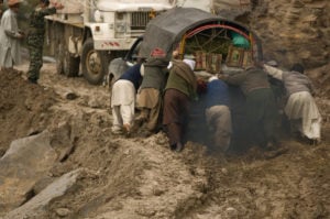
This is painfully apparent when it comes to floods. Another example, from the devastating Pakistan floods in 2022, shows that there was little preparedness on the ground despite the Pakistan Meteorological Department providing seasonal and monthly weather forecasts and putting out advisories on the likelihood of extreme rainfall.
There is a similar pattern of disconnect between forecasting authorities and grassroots stakeholders across the HKH region: When the 2013 Uttarakhand floods struck, the India Meteorological Department’s warning did not reach people at risk; During the floods in western Nepal in 2022, the country’s Department of Hydrology and Meteorology provided early warning through a three-day weather forecast and a special bulletin, but this did not materialise in effective action on the ground because the potential impact of the event was not communicated.
So, how do we ensure at-risk communities are not repeatedly unprepared for disasters? How can we tailor forecasts and early warning so that they are accessible, understandable, and actionable?
Moving towards impact-based forecasting
We need forecasts that indicate not only the likely weather conditions, but that also detail the likely impacts of such conditions on our communities, environments, and economies. A clearer picture of the consequences can help map more urgent and cogent anticipatory action.
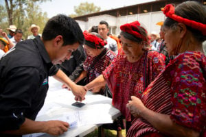
Impact-based forecasting involves providing information, not only about what the weather will be, but also what the weather will do. An early-warning advisory that includes only a weather forecast would say that a certain amount of rain is expected to fall within a certain timeframe. Impact-based forecasting would go many steps further, to indicate expected losses due to raised water levels in specific areas and sectors, such as livestock, farmlands and critical infrastructure. When co-produced with local stakeholders – including village representatives, community groups, and farmers – such forecasts invite greater understanding and ownership, which would facilitate comprehensive response plans and the allocation of funds.
As an example, in May 2021, the India Meteorological Department tracked Cyclone Yaas until it made landfall along the coastlines of Odisha and West Bengal in east India. The department produced precise warnings, such as explaining that the landfall would generate waves higher than rooftops in some areas. This information was conveyed through television, newspapers and loudspeaker announcements, and shared with the National Disaster Response Force to authoritatively position 4,800 well-equipped disaster workers in the two states.
Over a million people in the path of Cyclone Yaas were evacuated to cyclone shelters: The final death toll was 20. This figure could have been much higher, which speaks to the power of impact-based forecasting.
Reducing risk: The big picture
In the HKH region, the SAARC Disaster Management Centre (SDMC) and ICIMOD are leading organisations in facilitating information sharing and capacity building for disaster risk reduction.
In 2007, the SDMC developed a comprehensive framework on disaster management, which prioritised the establishment, strengthening and improvement of regional early-warning systems. The framework paved the way for the community-based flood early-warning systems that ICIMOD has piloted across the HKH, to considerable success. For example, a community-based flood early-warning system introduced by ICIMOD in the Ratu river in central Nepal has prevented loss and damage in Nepal and India.
ICIMOD and its partners have also developed many forecasting tools for early warning using Earth observation. These tools are customised for HKH countries and cover high-impact weather events, riverine floods, flash floods, droughts and forest fires. Countries use these tools as decision-support systems while generating advisories and early warnings.
However, to truly connect these forecasts and tools with effective anticipatory action, national meteorological and hydrological services need to work closely with the disaster management authorities, scientists and at-risk communities. Together, these groups need to adopt a holistic approach connecting observation, modelling, severe weather and natural hazard prediction, and anticipated impacts.
Key issues in building successful, impact-based early-warning systems
Impact-based forecasts will not only include information about hazards, but also the vulnerability and exposure of the location in question, as well as the timing, severity and impact the hazard is likely to have. Several groups, such as the World Meteorological Organization (WMO), the United Nations Economic and Social Commission for Asia and the Pacific (UNESCAP) and the Red Cross Red Crescent Movement, have developed guidelines for implementing impact-based forecasts. Drawing on these guidelines, the key step towards impact-based forecasting is to co-design and co-produce forecast productsby forging strong networks with national meteorological and hydrological services, national disaster management authorities, humanitarian agencies and at-risk communities.
For impact-based forecasting to be successful, who does what when must be made clear
This co-creation involves sharing best practices, enhancing knowledge of risks, and strengthening the interfaces among science, technology and policymaking to support anticipatory action. Further, the use of impact-based forecast information for more effective disaster preparednessrequires the use of social media, education and public awareness campaigns. All concerned parties, including the media and the public, must be made aware of impact-based forecasting for it to effectively communicate risk and trigger timely action and feedback.
For impact-based forecasting to be successful, who does what when must be made clear. The development of strong standard operating procedures can clearly define the roles and responsibilities of all stakeholders. Building capacity at national meteorological and hydrological services and national disaster management authorities is a priority, for which investment needs to be sought. To ensure the sustainability of these efforts, government budgets and agendas need to include anticipatory action and forecast-based financing mechanisms. The shift towards impact-based forecasting by national hydrometeorological agencies and the HKH’s disaster management authorities will be a step towards improving the early-warning value chain and anticipatory action. This means strong mechanisms and collaboration at national, regional, and global levels.
The Early Warnings for All initiative, co-led by the WMO and the United Nations Office for Disaster Risk Reduction, represents an opportunity for the HKH region to make progress in delivering actionable forecasts. Additionally, it will help in meeting the target of increasing the availability and accessibility of multi-hazard early-warning information by 2030, which is one of the Sendai Framework for Disaster Risk Reduction’s seven global targets.
Weather-related disasters pay no attention to borders. That is why a regional information service for HKH countries is vital. It would strengthen coordination and collaboration, establish best practices, build capacity and provide improved access to regional outlooks, issues, and trends. This serves as a platform, from which impact-based forecasting can be implemented, to significantly reduce disaster risks.