
Even before the main rains came, the pre-monsoon rains had saturated Nepal’s slopes. On 11 June the monsoon arrived, and with it disasters.
According to the National Disaster Risk Reduction and Management Authority (NDRRMA), 20 people are missing and five have been killed. Nearly 1,000 households have been displaced, 400 houses fully damaged and 100 partially damaged. Twenty bridges, seven roads and 14 hydropower stations have also been damaged so far.
Record rainfall in mountain districts
Record-breaking pre-monsoon rainfall set the stage for this devastation. Much of the rain fell in high mountain areas, especially the trans-Himalayan districts also called rain shadow areas, and the monsoon rains have continued the same pattern.
476%
More rain than average in the district of Mustang in May
In May, the normally arid northwest districts of Manang and Mustang recorded unusual levels of precipitation. Normally rainfall for May in Manang is 24 millimetres and 19 mm in Mustang, according to data from the Nepali government’s Department of Hydrology and Meteorology. This year they received 166 mm and 89 mm, respectively. “It was 693% more than normal for Manang and 476% for Mustang this year,” the department reported on its Facebook page.
The monsoon rainfall has also been much higher than normal. “In those districts about 60% of total monsoon rainfall for this year has already occurred in just a couple of weeks,” said Indira Kandel, head of climate analysis at the Department of Hydrology and Meteorology.
The rhythm of rainfall has changed in the past few years across the Himalayas including NepalArun Bhakta Shrestha, ICIMOD
On 15 June a massive flood hit Chame, the district capital of Manang. The rainfall that day was the second-highest recorded – 60.6 mm. The following day the region recorded the highest ever daily rainfall of 82.23 mm.
“This single event does not give a picture of what is happening with rainfall patterns, but we can certainly say that the rhythm of rainfall has changed in the past few years across the Himalayas including Nepal. [The] upward movement of rain is something that needs to be considered seriously and demands close monitoring to understand the changing climate,” said Arun Bhakta Shrestha, the regional programme manager looking at river basins and the cryosphere at the International Centre for Integrated Mountain Development (ICIMOD).
Shrestha’s colleague at ICIMOD, the water and climate specialist Santosh Nepal, said: “In the context of climate change, rainfall patterns are likely to change in the future including extreme rainfall events. In Nepal, intense precipitation (or extreme rainfall) events are likely to increase in frequency towards the end of the century as per the Climate Change Scenarios for Nepal report prepared for the National Adaptation Plan by the Ministry of Forests and Environment.”
Landslide leads to Melamchi river flood
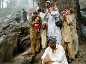
On the same day as the flood in Chame, another unusual event occurred. On 15 June, a massive flood wreaked havoc on towns and cities along the Melamchi river in central Nepal’s Sindhupalchowk district, 40 kilometres northeast of capital Kathmandu. At least six people were killed and 20 more are missing. Hundreds of homes were washed away.
Even weeks after the incident, experts are unsure of the exact origin of the flood.
Preliminary findings indicate the river was blocked by a huge landslide upstream in Bhremathang at an altitude of about 3,500 metres. This blocked the Melamchi river for about 45 minutes. “What we know till now is that it was a landslide-induced dam outburst flood,” said Rabin Raj Niraula, an environmental scientist who has been researching potential causes of the disaster. “From the past satellite images, we can see over 100 metres of thick glacial deposits in the area above the landslide area. It might be possible that such glacial deposits could have triggered a flood at the origin and then the large landslide downstream blocked the river temporarily that resulted in a huge flood.”
On 15 June, the water level in the river fell from 5 metres to 3 metres, according to data from a measuring station below the area where the landslide occurred. Then it rose to 6 metres within a few hours, and the measuring gauge itself was washed away by the river.
“The important lesson from this event is that the lower water level in the river must be communicated to downstream communities as importantly as high water level to save lives because low water level means something wrong is happening upstream. But authorities failed to communicate that important information in the case of Melamchi,” said Niraula.
Impact of the flood on isolated areas
Niraula was able to trace the landslide to Bhremathang thanks to a picture taken by Dorze Ghale, a local from a village called Chokpu. Ghale had taken a picture of a huge landslide about 6 kilometres upstream of Chokpu. He is now cut off from the rest of the world: the flood washed away a newly built road below his village.
On 24 June, a week after the incident, Ghale pleaded on Facebook for help. “Helambu and Melamchi [municipalities] are witnessing their worst days as electricity and communication networks have remained disconnected from 15 June. Villages do not have enough supplies and there are no other ways except chartering a helicopter to supply essentials and in case of emergencies,” Ghale wrote. When The Third Pole tried to call him on the phone number on his Facebook profile, it was switched off.
Experts who visited the flooded towns said the scale of destruction is massive. “We have brought in some water and debris samples from the places devasted by the river in the lower reaches for further investigation, as it was not possible to go to the upper reaches of the river as there are no bridges. Hyper-concentrated slurry that gushed into towns suggests that there could be some calcite ore upstream that formed such slurry as the river wasn’t flowing and was basically moving like a debris flow during the flood,” said Subodh Sharma, a professor of aquatic ecology at Kathmandu University who visited the site after the incident.
“It looks like when the turbid water started to enter the fishponds [local people] tried to protect those ponds instead of moving uphill to save their lives,” added Sharma. Ten trout fish farms have been washed away by the flood and most of the owners are missing.
The Melamchi feeds into the Indrawati and Sunkoshi rivers – both major tributaries of the Koshi river.
No preparation for landslides during monsoon in Nepal
The flood has affected the Melamchi Water Supply Project – the largest in the country. The project is diverting the river through a 27.5 km-long tunnel to ease water shortages in the Kathmandu Valley. Fortunately, the tunnel of the project was closed a day before the flood for maintenance. This saved it from being damaged, but its campsite was washed away. Three Chinese, three Indians and two Nepalis are missing.
“It’s sad to see that such a huge project with billions of rupees of investment had no preparation in the ground to face any disasters like this, no instruments being installed upstream to measure rainfall or landslide movement. This clearly shows how unprepared we are for disasters and a lack of seriousness while executing our developmental projects,” said Sharma, the professor at Kathmandu University.
It’s not that we don’t know things, it is more that we tend to ignore them, and it is costing us a lotSubodh Sharma, Kathmandu University
Sindhupalchowk was the hardest-hit district by the 2015 earthquake and has since become more prone to landslides. Experts have lobbied for monitoring changes at high altitudes. “Often the emphasis is given either to the glaciers and snow cover, but glacial deposits are often ignored, recent floods in Chamoli in Uttarakhand or the 2012 flood in western Nepal’s Seti river and now Melamchi have shown a pattern of disasters in high altitudes especially the areas of loose glacial deposits,” said Basanta Raj Adhikari, an engineering geologist at the Institute of Engineering in Nepal’s Tribhuvan University.
These incidents happened just a few days after Anil Pokhrel, the chief executive of the NDRRMA, warned that this monsoon season could be more destructive than last year’s, during which over 400 people died from landslides alone. “Wildfires that raged for months burnt through forest-shrub cover, undermining the ability of mountain slopes to absorb rainfall and prevent soil erosion. This could potentially result in more landslides and floods,” wrote Pokhrel. “Given all these considerations, it would be naive to hope that everything will be all right in the next few months, but the slopes are already saturated by pre-monsoon rains, and this does not bode well.”
Despite knowledge of the changing climate, and the risks that Nepal faces, little has been done to prepare in the last few months. The Melamchi disaster highlights how costly this is. “It’s not that we don’t know things, it is more that we tend to ignore them, and it is costing us a lot,” said Sharma.
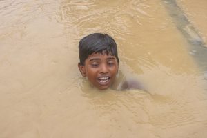
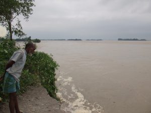
Downstream dangers
The lack of preparation, and its impact, is not isolated to Nepal. The heavy rains have led to flood warnings in the Indian state of Bihar, downstream of Nepal. Despite tens of thousands of kilometres of embankments promoted as a solution to floods, the state remains critically vulnerable. From Khagaria, to Gopalganj, to Muzaffarpur, the predictions of water rise range from 5 cm to 35 cm by 2 July.
![The Mahakali river at the India-Nepal border, downstream of the Sharada barrage [Image by: Joydeep Gupta]](https://dialogue.earth/content/uploads/2020/03/Mahakali_Sharada_barrage_JG-300x225.jpg)