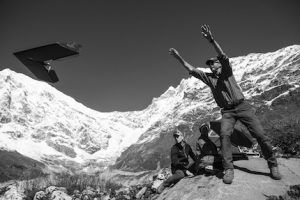

A group of international scientists from the Kathmandu-based International Centre for Integrated Mountain Development (ICIMOD) and Utrecht University in the Netherlands have used drones to map the Lirung glacier in the Lantang mountains of northern Nepal.
Scientists say this new technology will revolutionise our understanding of how glaciers are changing.
The Himalayan glaciers are known as Asia’s water tower because they feed the region’s major rivers, which supply water to a fifth of the world’s population. While scientists know the glaciers are melting, they do not understand how particular glaciers are affected, or how glacier melt will affect future river flow.
Himalayan glaciers remain relatively unstudied because of the remote and inaccessible terrain and hazardous conditions for fieldwork. Until now researchers have relied on data from satellite or aerial image, which is not very accurate.
“For years we have been using remote sensing to learn about hydrology of the Himalayas but the technology development around unmanned Ariel vehicles and the software to process the images has advanced so much that we can study the dynamics of the glaciers at unprecedented details by using these devices,” said Steven De Jong, a member of the research team from Utrecht university.
The scientists programmed drones to fly over the 3.5 kilometre-long Lirung glacier and take thousands of high-resolution photos, both before and after the monsoon season. The images were then processed to reveal detailed information about the glacier surface.
“It’s tough and time consuming to do a field survey of such large glaciers so these devices can help to get more accurate images. The result is better predictions of glacier changes,” said Dr. Arun Bhakta Shrestha, team member from ICIMOD.
Their findings show the glacier is losing mass, but that melting is higher around the small lakes that form on top of the ice and along ice cliffs within the glacier, according to a research paper published last month.
The team used drones along with other devices to measure temperature and rainfall around Lirung in order to better understand the water system of the Himalayas. ““We’ve shown it is possible in one catchment but given the variety in the region we need to extend this to other areas of the Himalayas,” said Dr Walter Imerzeel from Utrecht University.
A recent study, based on satellite data, revealed about a quarter of glaciers in Nepal and Bhutan have disappeared over the last 30 years.
This is not the first time that the drones have been used for environmental purposes in Nepal. In 2012, drones were used in Chitwan National Park to monitor tiger and rhino populations and catch illegal poachers operating in protected areas. Drones are also being used in other areas of the region. China, for example, is using drones to collect meteorological information and monitor herds of rare wild yaks.
[youtube http://www.youtube.com/watch?v=U1PGFm7EoEE]