Photographer Nabin Baral captures the diverse landscape of the free flowing river before it’s stemmed by mega dams in Nepal
Share this article
Copy link to page
Copy link to page
Republish this article
We encourage you to republish Dialogue Earth articles, online or in print, under the Creative Commons license. Please read our republishing guidelines to get started.
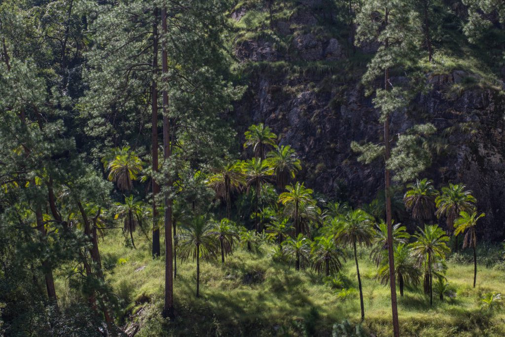
The Karnali River is older than the Himalaya, having cut its path over millions of years as the mountains rose. This phenomenon has created many wild and scenic gorges with rich biodiversity.
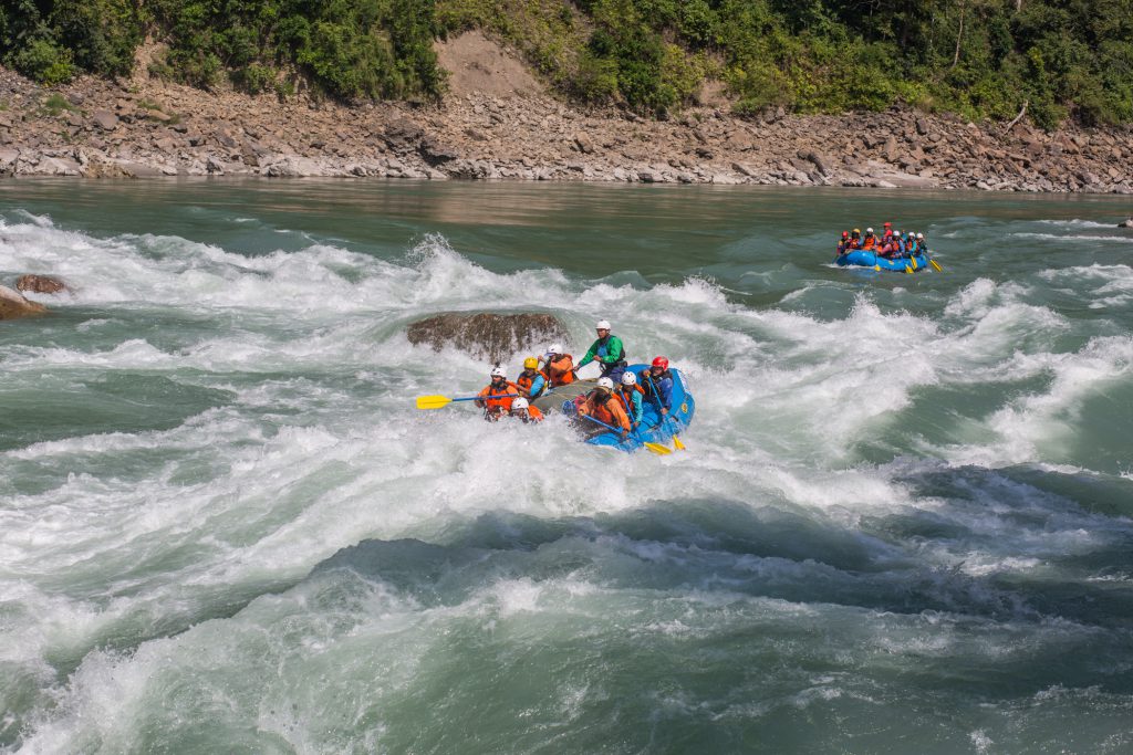
In Nepal, the Karnali is still largely untouched by the modern development like roads and dams, but mega dams are in the pipeline in Nepal. Currently only two dams in Tibet and one barrage in India disturbs its flow.
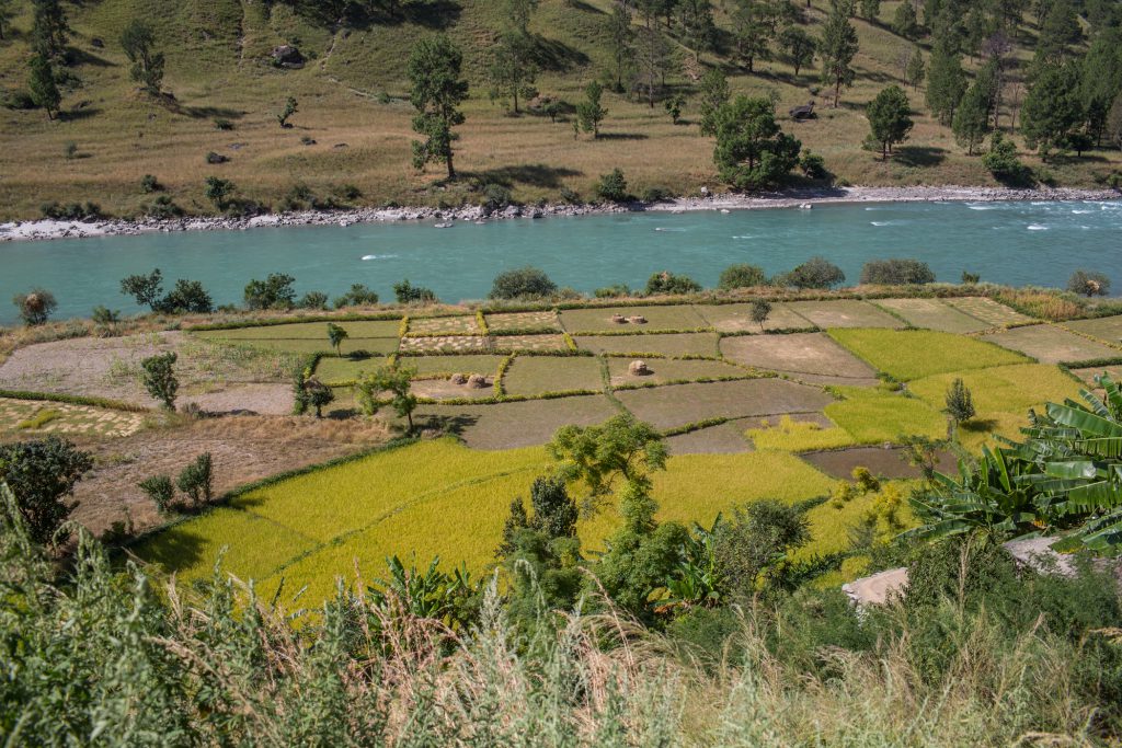
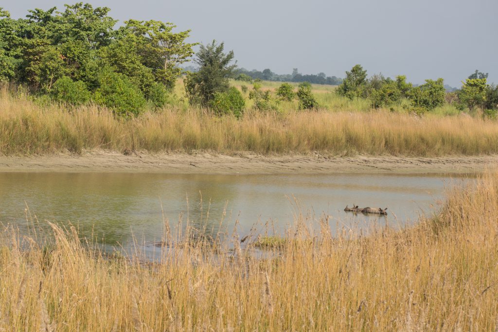
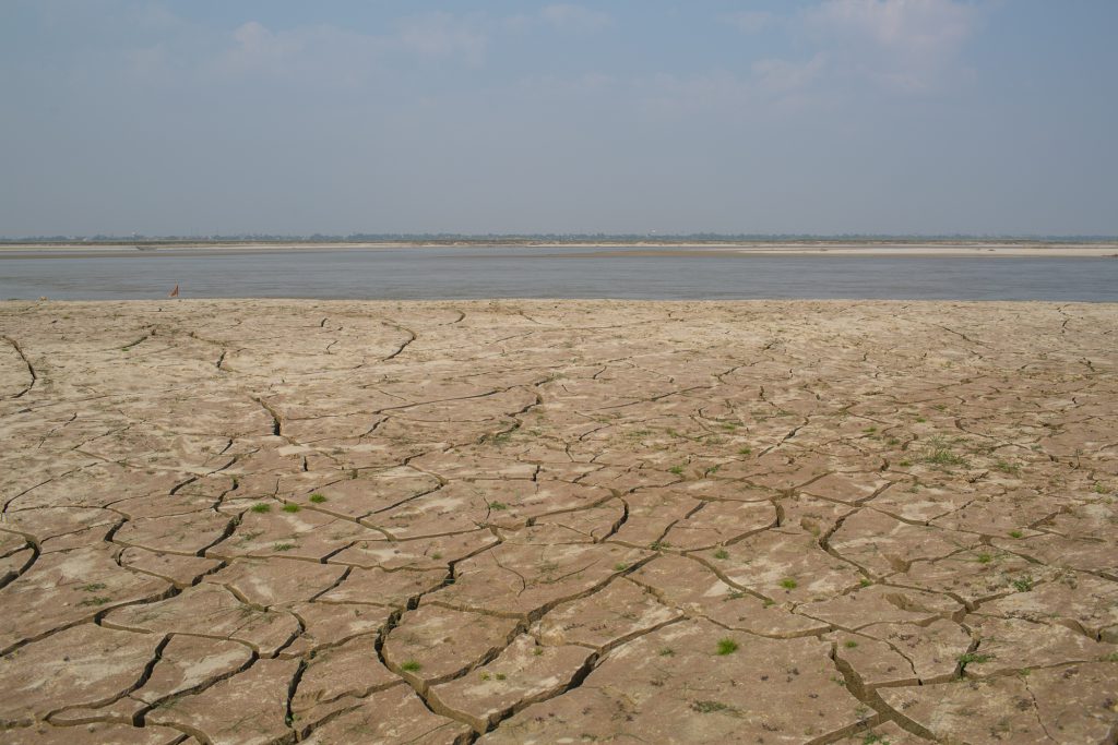
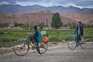
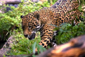
The Karnali River in the semi-desert landscape of Humla district of Nepal, near Hilsa on the Tibet border. This area is home to the snow leopard [image by: Nabin Baral]A view of Karnali River cutting through rising mountains before Yangar village in the Humla district of Nepal [image by: Nabin Baral]The Karnali River below Shreenagar village in Humla, Nepal [image by: Nabin Baral]At the altitude of 1,500 metres the river surprises with alpine forests and palm trees growing together on the river banks in Humla Nepal [image by: Nabin Baral]Rice terraces on the flood plains of Karnali River below Shreenagar village, Humla [image by: Nabin Baral]The first scientific expedition team on the Karnali River raft God’s House rapids, one of the world class rapids on the river on the border of Achham and Surkhet districts [image by: Nabin Baral]The scientific expedition team camps by the side of Karnali River in the Kailali district of Nepal [image by: Nabin Baral]An old castle like structure carved into the rock along the Karnali River in Surkhet district of Nepal [image by: Nabin Baral]Two one horned rhinos in Bardia National Park of Nepal. The flood plains of the river are the source of water for endangered tigers and rhinos. The park covers 968 square kilometres and is the largest and least disturbed national park in Nepal [image by: Nabin Baral]The Karnali/Ghaghara River, a few metres before meeting the Ganga in India, and about 100 kilometres northwest of Patna. From India the Ganga then enters Bangladesh where it meets the Brahmaputra. Both rivers then reach the Bay of Bengal in the Indian Ocean [image by: Nabin Baral]This story is jointly published by thethirdpole.net and Nepali Times.
![<p>Mapcha Khambab River in Tibet, China. Mapcha Khambab means peacock’s mouth in Tibetan and is named after a spring which is the spiritual source of the river. The river becomes the Karnali in Nepal and the Ghaghara in India [image by: Nabin Baral]</p>](https://dialogue.earth/content/uploads/2019/01/Free_Wild-and-Scenic_Photo-Story-1-300x200.jpg)

![The Karnali River in the semi-desert landscape of Humla district of Nepal, near Hilsa on the Tibet border. This area is home to the snow leopard [image by: Nabin Baral]](https://dialogue.earth/content/uploads/2019/01/Free_Wild-and-Scenic_Photo-Story-2-1024x683.jpg)
![A view of Karnali River cutting through rising mountains before Yangar village in the Humla district of Nepal [image by: Nabin Baral]](https://dialogue.earth/content/uploads/2019/01/Free_Wild-and-Scenic_Photo-Story-5-1024x683.jpg)
![The Karnali River below Shreenagar village in Humla, Nepal [image by: Nabin Baral]](https://dialogue.earth/content/uploads/2019/01/Free_Wild-and-Scenic_Photo-Story-14-683x1024.jpg)
![The scientific expedition team camps by the side of Karnali River in the Kailali district of Nepal [image by: Nabin Baral]](https://dialogue.earth/content/uploads/2019/01/Free_Wild-and-Scenic_Photo-Story-20-1024x683.jpg)
![An old castle like structure carved into the rock along the Karnali River in Surkhet district of Nepal [image by: Nabin Baral]](https://dialogue.earth/content/uploads/2019/01/Free_Wild-and-Scenic_Photo-Story-22-1024x683.jpg)
![Kagbeni is a small village located in the Kali-Gandaki Valley. The Gandaki River originates in the Himalayas and flows through [image by: Justin Falcone]](https://dialogue.earth/content/uploads/2019/01/Mustang1-300x200.jpeg)