The rivers flowing from Bhutan into India have changed dramatically in the last few years. Small Himalayan rivers like the Gaurang, Beki, Namlang, Daranga and many others which used to be well fed in the months of June and July now run dry. Even transboundary rivers originating in the sub-Himalayan areas such as the Sunkosh, Manas, Champabati, Aai and Dhanshiri are running shallow.
These changes are new, barely a decade old, and not well understood. They follow from repeated flash floods that have resulted in the dumping of a huge amount of sediment and silt. This has changed even the slope of the riverbeds, making them far less steep, slowing down the flow of river waters.
Glacial Lake Overflow Floods (GLOFs), cloud bursts and Landslide dam outburst flood (LSDOFs) have all resulted in flash floods. While flash floods are significantly different from normal floods in terms of cause, propagation, intensity, impacts, predictability and management they are generally not investigated as a separate class of events but are rather reported as a part of the overall seasonal floods situation. This means that these new activities are neither reported on, nor managed, in a manner that would best suit them.
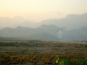
Moreover the floods now carry massive sand deposits as the sharp hills have been eroded by the waters. It is suspected many mining and development activities like dam building may also be responsible for sand and stone deposition in the river beds.

As Bhutan has become richer, and invested more in dam building and infrastructure this development has led to further erosion. The sediment resulting from these activities – mostly sand, boulders, pebbles and shingles – now choke the transboundary rivers. This type of sediment contains less organic nutrients, which negatively impacts agriculture in these regions. Sand deposits used to extend from 5 to 10 kilometres in to the southern plains as the rivers entered the state of Assam. Now, according to local people, this area has stretched to at least 20 kilometres downstream.
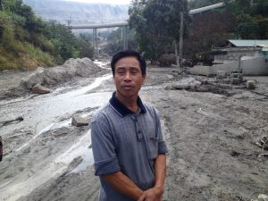
Anil Swargiary, a local farmer said, “Flash floods that become frequent in the last 10-15 years are responsible for this transformation. Every year flash floods erode the river bank in different directions and the river bed became shallow, wide and full of sand. Flash floods transformed vast stretches into deserts within the last two decades. In some areas sand deposition is as deep as 7 feet. Land along the river banks full of alluvium yielded rich harvests two decades back are now abandoned due to desertification.” In the past land that had been inundated by floods could be reclaimed in 3 to 5 years, but now in some cases no vegetation has arisen even after fifteen years.
As the river flow become less regular the people living downstream move away from the river into the forests, leading to deforestation and encroachment.

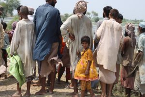
A change in Himalayan river system has, therefore, now triggered changes in the population distribution, density, migration and occupations of the people that live beside them. The inhabitants of the India-Bhutan border are by and large poor, and depend heavily on the land and natural resources for their livelihoods.
Water flowing from Bhutan’s Himalayas sustains the lives and livelihoods of millions of people residing in plains of Assam and West Bengal. More than 80% of people in the region live near rivers to have water accessibility. Some 70% of the region’s population is food-energy deficient, a proportion almost as high as that in desert region. At the same time rice, the staple food in the region, requires huge amounts of both water and energy to grow. For many families collecting drinking water is an arduous task. Generally women walk half a kilometre or more to fetch water. On the other hand, with loss of livelihood, many young people have turned to the business of sand mining and stone crushing both legally and illegally.
According to Professor Abani Kumar Bhagwati, department of geography in Gauhati University, climate change and local deforestation are mostly to blame. “Deforestation wiped out natural barriers to check the materials that are carried by the rivers and flash floods and deposited in the wider river-beds in the plains. Apart from rising temperatures in the Hindu-Kush Himalayas as a whole, intense seasonal precipitation in the Bhutan Himalayan foothills triggers a variety of natural hazards,” he said.
The geomorphology of the rivers has also changed. The rivers have bhabar formations. These consist of alluvial sediments, but now they are mixed with boulders, pebbles, sand and silt. As the bhabar have changed they have caused erosion around the wider edges of the river, widening the rivers, and sometimes causing the rivers to flow out of their banks, cutting through the fertile fields and causing erosion in the plains.

A combination of building activity in Bhutan, and changes in rainfall patterns are now making major changes to the land, having knock-on effects that few can fully foresee. Unfortunately because the effects are felt most by the poor, researchers and the policy community have paid little attention. It may be wise for researchers to start looking at these neglected areas before the changes become irreversible.